
October 30, 2026 · Flood Zone Guide
Dayton Flood Insurance: The 55-Mile Miami Conservancy District Levee System, the October 2022 Montgomery County Map Update, and the Zone X vs. Zone AE Address Check That Decides Whether Your Lender Requires FEMA Coverage

A Dayton home near the Great Miami River requires mandatory FEMA flood insurance only when the parcel sits inside a Special Flood Hazard Area (SFHA) on the effective flood map: Zone A or Zone AE. Behind an accredited Miami Conservancy District levee, the protected land is mapped as Zone X and the federal mandate does not apply. Outside the levees, or behind a levee that has not been accredited, the same address is mapped in the floodplain and any federally backed mortgage triggers the purchase requirement. The deciding step is a parcel-level check at the FEMA Flood Map Service Center against your community's effective panel, not a guess based on which side of the river the house sits.
The confusion is understandable: the Miami Conservancy District's flood protection system has kept the river out of downtown Dayton since 1922, so buyers reasonably assume the water can never touch their house. In our experience helping buyers and sellers in the Miami Valley, the flood question is where contracts most often stall, usually because no one ran the address check until the lender's flood determination arrived in week three. Here is how the levee system, the FEMA maps, and the insurance mandate actually fit together, with a source and an access date for every figure.
Does a Home Near the Great Miami River in Dayton Require Mandatory FEMA Flood Insurance?
Not automatically, and not because of the river. The requirement attaches to the mapped zone, not the distance to water. The Flood Disaster Protection Act of 1973 forbids federally regulated and federally backed lenders from making, extending, or renewing a mortgage on improved real estate inside an SFHA unless flood insurance stays in force for the life of the loan. An SFHA is the land in the 1 percent annual-chance floodplain, mapped as Zone A, Zone AE, AH, AO, AR, or A99 (and V zones on coasts). Along the Great Miami River in the Miami Valley, most of the developed valley floor sits behind Miami Conservancy District levees, and when a levee meets FEMA's accreditation standards under 44 CFR 65.10, the land behind it is mapped as Zone X, outside the SFHA, so the federal mandate drops away. When a levee has not been accredited, FEMA maps the land behind it as if no protection existed: Zone AE, with a mandatory-purchase trigger for any federally backed loan. The answer for a specific house is therefore a specific check, and the sections below walk through it step by step.
What Is the Miami Conservancy District Levee System, and How Much of Dayton Does It Protect?
The system exists because of the Great Dayton Flood of 1913. Between March 21 and March 26, 1913, roughly 9 to 11 inches of rain fell across the Miami Valley in about three days, sending an estimated 4 trillion gallons of water down the rivers. Around 360 people died, more than 20,000 homes were destroyed, and downtown Dayton sat under as much as 20 feet of water. Ohio responded with the Conservancy Act, and the Miami Conservancy District was organized in 1915 with Arthur Morgan as its engineer. The system was built between 1918 and 1922 and has protected the valley since, the first regionally coordinated flood control system in the United States and a designated ASCE Historic Civil Engineering Landmark.
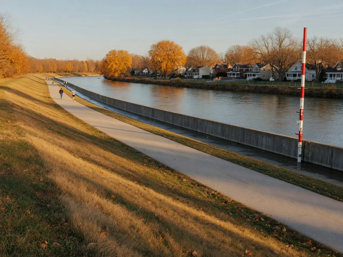
The system has three parts: five dry dams, about 55 miles of levees and floodwalls, and improved channels. The five dams are Englewood Dam on the Stillwater River, Germantown Dam on Twin Creek, and Huffman Dam, Lockington Dam, and Taylorsville Dam on the Great Miami River itself. They are gateless and hold no permanent reservoir: the basins sit dry and store floodwater only after heavy rain. Englewood Dam is the largest at roughly 4,716 feet long and 110 feet high, with about 209,000 acre-feet of storage across 6,350 acres.
The levees protect the developed valley from Piqua south to Hamilton: Piqua, Troy, Tipp City, Huber Heights, Dayton, Moraine, West Carrollton, Miamisburg, Franklin, Middletown, and Hamilton (Huber Heights and Moraine joined about 40 years after the original nine). The district reports the system protects around 1 million people, 47,000-plus properties across 22 cities, 5 counties, and 18 townships, and roughly $10 billion in land and buildings. The design target was the Official Plan Flood: a storm the size of 1913 plus 40 percent.
Why Does Levee Accreditation Decide Whether a Home Is Mapped in a Flood Zone?
FEMA's Flood Insurance Rate Map (FIRM) shows where the base flood, the 1 percent annual-chance event, would go. A levee changes that picture only when it meets federal standards for design, operation, and maintenance under 44 CFR 65.10, and the levee owner must submit engineer-certified data to prove it. The Miami Conservancy District owns and operates the levee system, so it is the entity working through FEMA's accreditation process. The mapping outcomes are three:
- Accredited levee: the land behind it is mapped as Zone X (shaded), the moderate-hazard residual-risk area between the 1 percent and 0.2 percent annual-chance floods. No federal flood insurance mandate applies, though FEMA recommends voluntary coverage.
- Provisionally accredited levee: mapped as provisional Zone X while the owner compiles the 44 CFR 65.10 documentation.
- Non-accredited or de-accredited levee: the land behind it is mapped into the SFHA as if the levee did not exist, usually Zone AE, and the mandatory purchase requirement applies.
A note on what accreditation is not: it is a mapping and lending standard, not a guarantee. Levees can be overtopped, seep through, or fail, and FEMA is explicit that more than 20 percent of NFIP claims come from properties outside the mapped high-risk zone. Accreditation tells you what the lender will require; it does not tell you the house can never flood.
| FEMA zone | What it means near the Great Miami | In the SFHA? | Mandatory flood insurance? |
|---|---|---|---|
| Zone A | 1% annual-chance flood; no base flood elevation calculated; used where detailed study data is limited | Yes | Yes, for federally backed loans |
| Zone AE | 1% annual-chance flood with a base flood elevation; typical of the undeveloped floodplain and land behind non-accredited levees | Yes | Yes, for federally backed loans |
| Zone AH / AO | Shallow 1% flooding, ponding or sheet flow 1 to 3 feet deep | Yes | Yes, for federally backed loans |
| Floodway | The river channel plus the strip that must stay open so the base flood passes without raising water levels; fill and new construction are tightly restricted | Part of the parent AE zone | Same as the parent zone |
| Zone X (shaded) | Between the 1% and 0.2% annual-chance floods; typical of land behind accredited Miami Conservancy District levees | No | No, but lenders may still require it |
| Zone X (unshaded) | Outside the 0.2% annual-chance floodplain | No | No |
| Zone D | Flooding possible but undetermined; no flood hazard analysis performed | Uncertain | The lender's own determination decides |
Sources: FEMA FIRM legend and glossary (Zone D), FEMA How to Read a Flood Map tutorial, and FEMA floodway guidance, all accessed October 30, 2026. Mandatory-purchase rule from the Flood Disaster Protection Act of 1973 as administered by FEMA and federal lending regulators. General education, not insurance or legal advice.
How Do I Check Whether a Specific Dayton Address Is in a Flood Zone?
Four steps, none of which take more than a few minutes:
1. Run the FEMA Flood Map Service Center address search. At msc.fema.gov/portal/search, enter the street address and the tool returns the effective FIRM panel and whether the address falls in an SFHA. You can generate a printable FIRMette, the two-page official excerpt of the parcel's map panel, which is useful to keep with the offer paperwork.
2. Cross-check the county tools. The Montgomery County Auditor GIS at mcohio.org/629/GIS provides parcel-level search, and the county Business Services division hosts an Interactive Flood Risk Map, the official FEMA panels, the Flood Insurance Study, and the county Flood Damage Prevention Regulations at selectmcohio.com.
3. Contact the floodplain administrator. For the City of Dayton, the Ohio Department of Natural Resources (ODNR) published Floodplain Administrators list names the city's Chief Building Official as the contact; Montgomery County matters go through the Business Services Building Regulations Division at 451 W. Third St. in Dayton. Confirm the current contact when you call.
4. Know your panel's effective date. Montgomery County's current FIRMs vary by watershed: the Little Miami River portion went effective October 27, 2022, many older county panels date to January 6, 2005, and the Great Miami River portion was under a FEMA study update beginning around 2020, with updated maps planned. The FEMA Community Status Book for Ohio tracks each community's effective dates, and Kettering's flood-mapping page documents the same split.
What Changed in Montgomery County's Flood Maps in 2022, and What Is Still Being Studied?
The map you rely on today is not the map of 2005. FEMA began updating its hydrologic and hydraulic analysis of the Great Miami River in Montgomery County around 2020, and Kettering's own flood-mapping page confirms the split: the Little Miami River watershed portion of the county's maps went effective October 27, 2022, while the Great Miami portion remains under study with updated maps planned. On the levee side, the Miami Conservancy District has been working through FEMA's reaccreditation program for years: it was required to submit 12 levee systems in Miami, Warren, and Butler counties, it completed capital improvements that led to accreditation of the Franklin levee after 2016 improvements, and it continues the work as FEMA updates the underlying hydrology.
The district has also published a long-term investment need of about $140 million for the regional system, reported by the Dayton Daily News, to prevent failures. That is a maintenance figure, not a map change, but it is a reminder that accreditation status is a moving target: verify it at the time you buy rather than assuming it holds forever.
How Much Does Flood Insurance Cost Near the Great Miami, and Did Risk Rating 2.0 Change the Math?
FEMA replaced its zone-based NFIP pricing with Risk Rating 2.0 in two phases: new policies priced under the new method from October 1, 2021, and all renewals from April 1, 2022. Premiums are now property-specific and consider flood frequency, the flood source (riverine versus rainfall), distance to water, elevation relative to flooding, the structure's replacement cost, and whether there is a basement. The old zone letter no longer drives the price. The subsidized Pre-FIRM rates for structures built before the community's first map are being phased out, and annual premium increases are capped at 18 percent for most policyholders (25 percent for certain Pre-FIRM non-primary residences, businesses, and severe repetitive loss properties), so the transition is gradual.
The practical consequence: two similar homes can price very differently, and the only real number is a quote from a licensed agent using your address and structure details. Ohio participation in the NFIP is low, roughly 1 in 218 households by one insurance-industry count, so most buyers in the Miami Valley have never priced a policy; do it before you write an offer, not after. FloodSmart.gov's eligibility tool explains the mandate and how to buy. Insurance, lender, and mortgage topics in this post are general education and flagged for compliance review; they are not financial or legal advice, and you should confirm your specific requirement with your lender and a licensed insurance agent.
Buyer and Seller Takeaways
- Buyers: run the FEMA Flood Map Service Center address lookup and pull a FIRMette before you write an offer. The zone letter on the panel, not the river view, decides the mandate.
- Buyers: ask whether the home sits behind a Miami Conservancy District levee and whether that levee is currently accredited. Behind an accredited levee the map is Zone X; behind a non-accredited one it is Zone AE.
- Buyers: if the parcel is Zone A or AE, budget mandatory flood insurance into the monthly payment and get a Risk Rating 2.0 quote from a licensed agent early in the process.
- Buyers: if the home sits in the floodway or floodplain, check the community's Flood Damage Prevention Regulations (Dayton's are in Code of Ordinances Chapter 152, Division 3) before planning any addition; floodway development typically requires a no-rise analysis.
- Sellers: assemble your FIRMette, any elevation certificate, and your flood insurance history before listing. A clean flood packet answers the question before it becomes a contingency.
- Everyone: this is general education about flood mapping and insurance rules, not legal, tax, title, insurance, or financial advice. Consult your lender, a licensed insurance agent, your title company, and a qualified attorney for your specific transaction.
If you are weighing a home along the Great Miami, our Greater Dayton region guide maps the whole Miami Valley market, and the Miamisburg market watch covers one of the leveed river cities in detail. Out-of-state buyers can start with our guide to relocating to Dayton from out of state, and anyone pricing ownership should read our breakdown of why Dayton homeowners insurance rates are rising before comparing quotes. The Huber Heights neighborhood page shows how a leveed community between the Great Miami and the Stillwater rivers actually lives. The levee system is one of the reasons the Miami Valley is such a resilient place to own a home, and knowing what the map says is the first step to sleeping well in it.
Frequently Asked Questions
Does a home behind the Miami Conservancy District levees in Dayton require flood insurance?
Only if the effective FEMA map places the parcel in a Special Flood Hazard Area. Behind an accredited levee the land is mapped Zone X, so no federal mandate applies, though FEMA recommends voluntary coverage and more than 20 percent of NFIP claims come from outside the mapped high-risk zone. Behind a non-accredited levee the land is mapped as if the levee did not exist, Zone AE, and the mandate applies to federally backed loans.
What flood zone is most of downtown Dayton in on the current FEMA map?
The levee-protected valley floor in Dayton is mapped as Zone X (shaded) where the Miami Conservancy District levee system meets accreditation standards. The undeveloped floodplain riverward of the floodwalls, including the river corridor itself, is mapped as Zone AE with a mapped floodway. Verify the exact parcel at the FEMA Flood Map Service Center, because the boundary between the two runs along the levee line, not along a street.
How do I check if a home I am buying is in a Special Flood Hazard Area?
Enter the address at the FEMA Flood Map Service Center (msc.fema.gov/portal/search), generate a FIRMette for the parcel, and cross-check the Montgomery County Auditor GIS and the county's floodplain map at selectmcohio.com. Your lender will also run a Standard Flood Hazard Determination before closing; run yours first so the answer is not a surprise in week three.
What is the difference between Zone AE and Zone X on a Dayton flood map?
Zone AE is inside the Special Flood Hazard Area: land with a 1 percent annual chance of flooding and a published base flood elevation, where federally backed mortgages require flood insurance. Zone X, shaded or unshaded, is outside the SFHA: moderate or minimal risk, with no federal mandate. The levee accreditation decision is what moves a parcel from one side of that line to the other.
What does Zone D mean on a FEMA flood map?
Zone D marks areas where flooding is possible but undetermined because no flood hazard analysis has been performed. It is not a safety guarantee. Lenders make their own determination on insurance for Zone D parcels, so ask the lender directly and consider a voluntary quote regardless of the answer.
Do Ohio sellers have to disclose that a home is in a flood zone?
Yes, through the state's Residential Property Disclosure Form under Ohio Revised Code 5302.30. Section J asks whether the property is located in a designated flood plain, and FEMA's flood maps establish that designation, so a seller who knows the parcel is in a mapped floodplain must answer accordingly. Section K separately asks about any known prior or current flooding, drainage, settling, or grading problems. The form is answered from the seller's actual knowledge in good faith, and "Unknown" is a permitted answer, but it does not replace the question.
Sources
- FEMA Flood Map Service Center (address-based lookup; effective panel, SFHA status, printable FIRMette)
- FEMA, Living with Levees: Homeowners, Renters, Business Owners (accredited vs. non-accredited mapping; Zone X behind accredited levees; mandatory purchase)
- eCFR, 44 CFR 65.10, Mapping of Areas Protected by Levee Systems (accreditation standards for design, operation, and maintenance)
- FEMA, Guidance for Flood Risk Analysis and Mapping: Levees (November 2022) (accredited, provisionally accredited, and non-accredited mapping outcomes)
- Miami Conservancy District, Levee System (55 miles of levees and floodwalls; 12 levee systems in Miami, Warren, and Butler counties; reaccreditation work; Franklin levee accredited after 2016 improvements; businesses and residences behind accredited levees exempt from mandatory flood insurance)
- Miami Conservancy District, The Great Flood of 1913 (March 21-26, 1913; 9-11 inches of rain in three days; ~360 lives; 20,000 homes destroyed; up to 20 feet of water in downtown Dayton)
- Miami Conservancy District, Integrated Flood Protection System (five dry dams, ~55 miles of levees and floodwalls, 35,000 acres of storage basins; designed for the Official Plan Flood, 1913 plus 40 percent; built 1918-1922)
- Miami Conservancy District, Dry Dams (Englewood, Germantown, Huffman, Lockington, Taylorsville; gateless, no permanent reservoir)
- Miami Conservancy District, Englewood Dam (largest dam; ~4,716 feet long, 110 feet high; ~209,000 acre-feet of storage across 6,350 acres)
- Miami Conservancy District, Protecting from Flooding (~1 million people, 47,000-plus properties, 22 cities, 5 counties, 18 townships, ~$10 billion protected)
- ASCE, Miami Conservancy District Historic Civil Engineering Landmark (first regionally coordinated flood control system in the U.S.)
- Miami Conservancy District, The Deed (2017) (Franklin levee accreditation; system scale and valuation)
- Dayton Daily News: MCD regional flood protection system has $140M in needs (long-term investment needs to prevent failures)
- FEMA, NFIP Risk Rating 2.0 (Phase I October 1, 2021; Phase II April 1, 2022; property-specific pricing; 18% annual cap, 25% for certain Pre-FIRM non-primary residences, businesses, severe repetitive loss)
- FloodSmart, NFIP Eligibility (mandatory purchase in SFHAs with government-backed mortgages; coverage limits)
- FEMA, How to Read a Flood Map (Zone X shaded and unshaded definitions)
- FEMA Glossary, Zone D (possible but undetermined flood hazards)
- Montgomery County Business Services, Floodplain Information and Map (Interactive Flood Risk Map, official FEMA panels, Flood Insurance Study, Flood Damage Prevention Regulations)
- Montgomery County Auditor, GIS (parcel-level search)
- City of Kettering, Flood Mapping Updates (Little Miami watershed portion effective October 27, 2022; Great Miami portion under study with updated maps planned)
- FEMA Community Status Book, Ohio (community FIRM effective dates)
- Ohio Department of Natural Resources, Floodplain Administrators List (City of Dayton floodplain administrator contact)
- Great Miami Riverway, History (99-mile river corridor from Sidney to Hamilton; 12 riverfront communities)
- Ohio Revised Code 5302.30: Residential Property Disclosure (state-prescribed disclosure form; Section J flood plain question; Section K prior flooding, drainage, settling, grading)
- City of Dayton Code of Ordinances, Chapter 152, Division 3: Floodplain District Regulations (maps and studies review, floodplain administrator, permits, CLOMR for floodway encroachments; codified text)
- Flood zone, system scale, map update, and insurance facts reviewed October 30, 2026.
Share This Post
Suggested social caption
"Dayton flood insurance, explained with the data: the Miami Conservancy District's 55 miles of Great Miami levees and five dry dams protect about 47,000 properties, and the October 2022 Montgomery County map update split the county by watershed. Behind an accredited levee the map says Zone X and no federal mandate applies; outside it, Zone AE means mandatory FEMA coverage for federally backed loans. Here is the parcel-level check every buyer should run before the lender does. Verified October 30, 2026."
Published October 30, 2026 · Updated October 30, 2026 · Information verified on October 30, 2026 against the sources listed above. Flood maps, levee accreditation status, and insurance rules change; confirm the current panel, accreditation, and premium with FEMA, the Miami Conservancy District, Montgomery County, your lender, and a licensed insurance agent before you act.
Buying or selling along the Great Miami River?
Get a data-backed read on flood risk in the Dayton market: which communities sit behind accredited levees, what the effective map says for a specific address, and how the insurance math shows up in your monthly payment. We cover every corner of the Miami Valley.
Talk to an AgentExploring the Dayton market?
Whether you are comparing leveed river cities like Miamisburg, Huber Heights, Troy, and Tipp City or want to know what the FEMA map says for a specific address, a Glasshouse agent can pull the parcel data, the FIRMette, and the flood history before you look at a single listing.
No pressure, no guesswork. Just honest, local answers from a team growing across the Miami Valley and beyond.
Schedule a Consultation